PROJECT DOCUMENTS
View our plan for meaningful and equitable public engagement. To see what we’ve done so far, read our community engagement report and project summary.
Resource Materials
Not finding what you’re looking for? For historical documents before 2025, check out our Archived Resources.
Map Descriptions
Descriptions are provided for currently active maps only. Archived maps may not include descriptions.
Beginning at the western end of the corridor, the alignment starts along Security Boulevard at the Centers for Medicare & Medicaid Services (CMS) station area and proceeds east towards I-695. In this segment, there would be two travel lanes in each direction separated by a grass median. The travel lanes would be lined with a buffered bike lane and buffered sidewalks to the outside. The Red Line operates on an exclusive guideway along the south side of Security Boulevard, between the bike lane and the buffered sidewalk. Continuing east, the alignment serves the Security Square station at the Security Square Mall. East of the Security Square Station the guideway travels on a proposed bridge over I-695 and runs parallel to the I-695 on-ramp before the Social Security Administration (SSA) station, which is located along the back of the SSA development rather than the primary frontage along Security Boulevard.
The alignment then transitions to follow the I-70 corridor, where the exclusive guideway runs parallel to the highway along the northern side. Along this segment, the Red Line serves the I-70 Park-and-Ride station.
East of this location, the alignment approaches Cooks Lane, where it transitions from a surface configuration into the Cooks Lane Tunnel. In this segment, the Red Line descends below grade and operates in a twin-bore tunnel beneath the roadway for approximately one mile. The alignment turns east before returning to the surface along Edmondson Avenue at Glen Allen Drive. Along Edmondson Avenue it operates on a center-running guideway with stations at Edmondson Village, Allendale station at Allendale Street, and Rosemont station between Poplar Grove Street and N Franklintown Road. On either side of the guideway there would be two travel lanes in each direction with left-turn lanes as needed and on-street parking where available.
East of the Rosemont station, the alignment turns southeast onto Franklintown Road and then east onto Franklin Street. The alignment then splits with the eastbound track running along Mulberry Street and the westbound track running along Franklin Street forming a one-way pair otherwise known as a couplet. The alignment then continues to the West Baltimore MARC station.
From the West Baltimore MARC station, the alignment continues east toward the US 40 corridor. Within this area, a broad boundary indicates that multiple alignment options are under consideration (for further details, please see the US 40 Board). For Alternative 1, the compatible option is a center-running guideway within the US 40 median, positioned between the eastbound and westbound vehicular travel lanes on the US 40 Expressway. The Harlem Park station would be located between Carey and Calhoun streets.
Along the US 40 median, the Red Line operates in an exclusive median guideway, separated from adjacent traffic, before descending below grade near the Schroeder Street bridge. At this location, the alignment transitions from a surface configuration into the downtown tunnel.
Within the limits of the downtown tunnel, the street level would remain as existing unless improvements need to be made at station locations. The tunnel could be as low as 70 feet below the surface. The downtown tunnel starts in the grass median of US 40, near the Schroeder Street bridge. The tunnel section curves southeast under Mulberry Street and continues southeast under Fremont Avenue to the underground Poppleton station located near Baltimore Street. The tunnels would continue southeast, curving underneath Martin Luther King Jr. Boulevard and continuing beneath Lombard Street. The tunnel continues to the Baltimore Arena station located at Howard Street, then continues east to the Inner Harbor stations, which would be located near Light Street. The alignment would follow Lombard Street and then curve southeast under President Street and turn again to the east under Fleet Street. The Harbor East stations would be located along Fleet Street between Exeter Street and Central Avenue. The alignment would continue east under Fleet Street to the Fells Point Station near South Broadway. The Red Line would then continue east, curving to the southeast underneath Boston Street.
The tunnel would continue southeast under Boston Street and resurface east of Hudson Street to run within Boston Street until its intersection with S East Avenue. The Red Line would run on an exclusive guideway down the median of Boston Street. There would be a buffer with varying widths between the guideway and a travel lane in each direction, with on-street parking at some locations. The streets would be lined with a buffered bike lane and sidewalk between the curb and the buildings. The alignment continues within Boston Street to the Canton station which is located near S Lakewood Drive and continues toward S East Avenue. Beyond S East Avenue and ending at the eastern termini is the area encompassing the Brewers Hill/Highlandtown/Greektown areas connecting to Bayview. This area is shaded within a large boundary signifying that different options are still being considered within these limits. Within this boundary, there are stations at Canton Crossing, Highlandtown/Greektown near Haven Street at Eastern Avenue, Bayview station located on Bayview Boulevard within the Johns Hopkins University Bayview Campus, and a termini station within the Pulaski Industrial area on a parcel on the north side of Lombard Street close to the existing railroad line. The termini station is intended to make a connection with the future MARC Station.
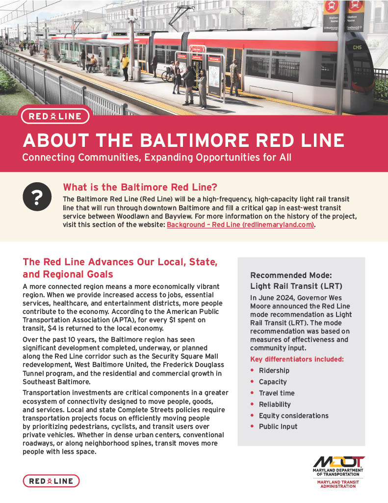
Key characteristics of Alternative 1 are that it is Light Rail Transit, there are potentially 19 stations, there is potentially a 7-minute peak frequency, and 10-minute off-peak frequency, and would potentially run from 5am to 2am the next day on weekdays.
Beginning at the western end of the corridor, the alignment starts along Security Boulevard at the Centers for Medicare & Medicaid Services (CMS) station area and proceeds east. In this segment, there would be two travel lanes in each direction separated by a grass median. The travel lanes would be lined with a buffered bike lane and buffered sidewalks to the outside. The Red Line operates on an exclusive guideway along the south side of Security Boulevard, between the bike lane and the buffered sidewalk. Continuing east, the alignment serves the Security Square station at the Security Square Mall and the Social Security Administration (SSA) station, which is located along the front of the SSA development.
East of the SSA station, the alignment continues along Security Boulevard before turning southeast toward the I-70 Park-and-Ride station which would be where the I-70 interchange is currently located. East of this location, the alignment approaches Cooks Lane, where it enters a mixed-use configuration. In this segment, the Red Line shares the lanes with general purpose traffic, with on-street parking provided along the south side of the roadway only.
Turning east onto Edmondson Avenue, the Red Line would operate on a center-running guideway with stations at Edmondson Village, Allendale station at Allendale Street, and Rosemont station between Poplar Grove Street and N Franklintown Road. On either side of the guideway there would be two travel lanes in each direction with left-turn lanes as needed and on-street parking where available.
East of the Rosemont station, the alignment turns southeast onto Franklintown Road and then east onto Franklin Street. The alignment then splits with the eastbound track running along Mulberry Street and the westbound track running along Franklin Street forming a one-way pair otherwise known as a couplet. The alignment then continues to the West Baltimore MARC station.
From the West Baltimore MARC station, the alignment continues east toward the US 40 corridor. Within this area, a broad boundary indicates that multiple alignment options are under consideration. One option is a center-running guideway within the US 40 median, positioned between the eastbound and westbound vehicular travel lanes on the US 40 Expressway. The Harlem Park station would be located between Carey and Calhoun Streets. Other options under consideration include configurations where the tracks continue on Franklin and Mulberry Streets as a couplet, or both tracks rejoin along Franklin Street. The Heritage Crossing station on the eastern end of the US 40 Expressway is only compatible with select options (for further details, please see the US 40 Board).
From this segment, the alignment continues east towards Martin Luther King Jr. Boulevard, where the route transitions into the downtown portion of the corridor.
The Red Line turns south onto Martin Luther King Jr. Boulevard until it turns east onto Baltimore Street and Lombard Street, forming a couplet. In the Martin Luther King Jr. Boulevard segment, there would be three travel lanes in each direction separated by a grass median. The northbound travel lanes would be lined with a buffered sidewalk. The exclusive guideway runs along the western curb between the southbound travel lanes and a shared use path, with grass medians on either side of the guideway.
Going south, the only stop on Martin Luther King Jr. Boulevard is the Poppleton Station located near Baltimore Street.
The Red Line would turn east and continue as a Baltimore Street/ Lombard Street couplet until they turn southeast onto President Street. Facing east along Baltimore Street, the train would run in an exclusive eastbound guideway along the southern curb. There would be two lanes of eastbound traffic and a turn lane where necessary, and one lane of parking where applicable. Facing east along Lombard Street, the train would run in an exclusive westbound guideway along the northern curb. There would be two lanes of westbound traffic and a turn lane where necessary.
Along Baltimore Street and Lombard Street, each direction of guideway would have stops at approximately the same cross streets. Going east, the next station is the Baltimore Arena stop near the intersection with South Howard Street. Rail interoperability between the Red Line and the existing light rail system is prohibited by geometry in the existing space. The next station is the Inner Harbor station located near Light Street, and then the Market Place station. Along Baltimore Street, the Market Place Station is near President Street. Along Lombard Street, the Market Place Station is near Market Place.
Each portion of the Baltimore Street/ Lombard Street couplet turns southeast onto President Street where they meet at the Lombard Street and President Street intersection. The Red Line continues along President Street, where it turns east to form another couplet. Along President Street, the Red Line would run on a median running exclusive guideway. Three northbound and two southbound travel lanes are lined on the outside by a grass buffered bike lane and a sidewalk on the outside of the bike lanes. The exclusive guideway runs within the median, having a grass buffer on the east side and a narrow concrete median on the west side.
The Red Line then turns east and continues as an Eastern Avenue/ Fleet Street couplet until they reach South Grundy Street. Facing east along Eastern Avenue, the train would run in an exclusive westbound guideway along the southern curb. There would be one lane of westbound traffic and a grass median that becomes a turn lane where necessary, and one lane of parking where applicable. Facing east along Fleet Street, the train would run in an exclusive eastbound guideway along the southern curb. There would be two lanes of eastbound traffic, one of which becomes a turn lane where necessary.
There are numerous stations along Eastern Avenue and Fleet Street where each direction of guideway would have stops at approximately the same cross streets. Going east, the next station is the Harbor East station, located between Exeter Street and Central Avenue, the Fells Point station located between Regester Street and Ann Street within the Fells Point Historic District, the Chester station located near South Chester Street, the Canton station near South Linwood Avenue, then the Highlandtown station located near South Highland Avenue.
Beyond South Grundy Street and ending at the eastern termini of the line is the area encompassing the Highlandtown/Greektown areas connecting to Bayview. This area is shaded within a large boundary signifying that different options are still being considered within these limits. Within this boundary, there is the Bayview station located on Bayview Boulevard within the Johns Hopkins University Bayview Campus, and termini station within the Pulaski Industrial area on a parcel on the north side of Lombard Street close to the existing railroad line. This termini station is intended to make a connection with the future MARC Station.
Key characteristics of Alternative 2A are that it is Light Rail Transit, there are potentially 21 stations, there is potentially a 7-minute peak frequency, and 10-minute off-peak frequency, and would potentially run from 5am to 2am the next day on weekdays.
Beginning at the western end of the corridor, the alignment starts along Security Boulevard at the Centers for Medicare & Medicaid Services (CMS) station area and proceeds east. In this segment, there would be two travel lanes in each direction separated by a grass median. The travel lanes would be lined with a buffered bike lane and buffered sidewalks to the outside. The Red Line operates on an exclusive guideway along the south side of Security Boulevard, between the bike lane and the buffered sidewalk. Continuing east, the alignment serves the Security Square station at the Security Square Mall and the Social Security Administration (SSA) station, which is located along the front of the SSA development.
East of the SSA station, the alignment continues along Security Boulevard before turning southeast toward the I-70 Park-and-Ride station which would be where the I-70 interchange is currently located. East of this location, the alignment approaches Cooks Lane, where it enters a mixed-use configuration. In this segment, the Red Line shares the lanes with general purpose traffic, with on-street parking provided along the south side of the roadway only.
Turning east onto Edmondson Avenue, the Red Line would operate on a center-running guideway with stations at Edmondson Village, Allendale station at Allendale Street, and Rosemont station between Poplar Grove Street and N Franklintown Road. On either side of the guideway there would be two travel lanes in each direction with left-turn lanes as needed and on-street parking where available.
East of the Rosemont station, the alignment turns southeast onto Franklintown Road and then east onto Franklin Street. The alignment then splits with the eastbound track running along Mulberry Street and the westbound track running along Franklin Street forming a one-way pair otherwise known as a couplet. The alignment then continues to the West Baltimore MARC station.
From the West Baltimore MARC station, the alignment continues east toward the US 40 corridor. Within this area, a broad boundary indicates that multiple alignment options are under consideration. One option is a center-running guideway within the US 40 median, positioned between the eastbound and westbound vehicular travel lanes on the US 40 Expressway. The Harlem Park station would be located between Carey and Calhoun streets. Other options under consideration include configurations where the tracks continue on Franklin and Mulberry Streets as a couplet, or both tracks rejoin along Franklin Street. The Heritage Crossing station on the eastern end of the US 40 Expressway is only compatible with select options (for further details, please see the US 40 Board).
From this segment, the alignment continues east towards Martin Luther King Jr. Boulevard, where the route transitions into the downtown portion of the corridor.
The Red Line turns south onto Martin Luther King Jr. Boulevard until it turns east onto Pratt Street, along the northern curb. In the Martin Luther King Jr. Boulevard segment, there would be three travel lanes in each direction separated by a grass median. The northbound travel lanes would be lined with a buffered sidewalk. The exclusive guideway runs along the western curb between the southbound travel lanes and a shared use path, with grass medians on either side of the guideway.
Going south, the only stop on Martin Luther King Jr. Boulevard is the Poppleton Station located near Baltimore Street.
After turning east onto Pratt Street, the Red Line continues until it turns south onto President Street. Pratt Street would comprise of the exclusive eastbound/westbound guideway running along the northern curb. There would be a grass buffer between the northern sidewalk and the guideway. To the south of the guideway, a grass median which becomes a turn lane when necessary, separates the trains from two eastbound travel lanes. South of the travel lanes, there is a grass buffered two-way bike lane, followed by sidewalk behind the southern curb.
Going east, the first stop along Pratt Street is the Convention Center station located near Howard Street. Due to the geometry at this location, interoperability between the Red Line and the existing light rail is feasible. The next station is the Inner Harbor station located near Light Street, and then the Market Place station located near Market Place.
The Red Line turns south onto the President Street where it then turns east to form a couplet along Eastern Avenue and Fleet Street. Along President Street, the Red Line would run on a median running exclusive guideway. Three northbound and two southbound travel lanes are lined on the outside by a grass buffered bike lane and a sidewalk on the outside of the bike lanes. The exclusive guideway runs within the median, having a grass buffer on the east side and a narrow concrete median on the west side.
The Red Line then turns east and continues as an Eastern Avenue/ Fleet Street couplet until they reach South Chester Street. Facing east along Eastern Avenue, the train would run on an exclusive westbound guideway along the southern curb. There would be one lane of westbound traffic and a grass median that becomes a turn lane where necessary, and one lane of parking where applicable. Facing east along Fleet Street, the train would run on an exclusive eastbound guideway along the southern curb. There would be two lanes of eastbound traffic, one of which becomes a turn lane where necessary.
Along Eastern Avenue and Fleet Street, each direction of guideway would have stations at approximately the same cross streets. Going east, the next station is the Harbor East station located between Exeter Street and Central Avenue, and the Fells Point station located between Regester Street and Ann Street within the Fells Point Historic District.
At South Chester Street, the Eastern Avenue portion of the couplet turns south to meet the Fleet Street portion of the couplet where they both turn southeast onto Boston Street. The Red Line would run on an exclusive guideway down the middle of Boston Street. There would be a buffer with varying widths between the guideway and a travel lane in each direction, with on-street parking at some locations. The streets would be lined with a buffered bike lane and sidewalk.
The line then continues along Boston Street to the Aliceanna station, located close to the Aliceanna Street intersection. The alignment continues within Boston Street to the Canton station which is located near S Lakewood Drive and continues toward S East Avenue. Beyond S East Avenue and ending at the eastern termini is the area encompassing the Brewers Hill/Highlandtown/Greektown areas connecting to Bayview. This area is shaded within a large boundary signifying that different options are still being considered within these limits. Within this boundary, there are stations at Canton Crossing, Highlandtown/Greektown near Haven Street at Eastern Avenue, Bayview station located on Bayview Boulevard within the Johns Hopkins University Bayview Campus, and a termini station within the Pulaski Industrial area on a parcel on the north side of Lombard Street close to the existing railroad line. The termini station is intended to make a connection with the future MARC Station.
Key characteristics of Alternative 2B are that it is Light Rail Transit, there are potentially 22 stations, there is potentially a 7-minute peak frequency, and 10-minute off-peak frequency, and would potentially run from 5am to 2am the next day on weekdays.